Showing posts with label Highways. Show all posts

Tuesday, August 3, 2010

Dead man's Curve

This is almost good news all around. DMN has the story of money intended for the completely unnecessary Trinity Toll Road to be shifted to de-highwaying 175 through South Dallas. Well, if we need to spend money on roads, might as well be to downgrade them rather than new capacity. As with many roads, new infrastructure (in this case 175) was thought to be the necessary investment for bringing jobs and investment to certain areas. When it is the wrong kind of infrastructure, the kind that severs community ties, local economies, and hinders real estate, that is hardly the formula for new investment.

Except apparently we can't get it all right. It looks like the arbitrary traffic formulas will win out and the road will be 6 lanes instead of the 4 that it should be.
"Traffic volumes and conformity dictate the need for six lanes versus four lanes," agency spokeswoman Cynthia White said. "The City of Dallas supports six lanes."
Conformity with what? TxDOT now has Context-Sensitive Design Manual. Dallas now has Complete Street Initiative in place. Why not conform to those? Actually leverage real investment in the part of town that needs it. After speaking with people involved with the bike plan, while doing field work, they reported that South Dallas is littered with 6-lane arterials that get maybe 5,000 cars a day. The formulas are above reproach.

Now if we wanted to make it 4 travel and 2 cycle tracks, to build expanding the burgeoning bike culture in Oak Cliff to South Dallas, than we'd be getting somewhere. If it goes to 6, I predict within ten years we end up taking it down to 4.

http://1.bp.blogspot.com/_D5kx0bUGx_c/S9ihpD3a8FI/AAAAAAAACUU/Wbop-nUdI-w/s1600/175.jpg

Thursday, April 22, 2010

Highway Dependence Begets Auto-Dependence, What's the Cost?


Well in NYC, the City and its residents save $19 billion annually.

The $19 billion number is a quick, conservative estimate that almost surely understates the savings New Yorkers reap by not driving. The study estimates that, per capita, New Yorkers drive nine miles per day. It then multiplies that figure by the national average cost of operating a vehicle, 40 cents per mile. Compare that total -- how much New Yorkers spend on driving, per capita -- to the national average, and you get $19 billion in savings.

Here's why that's a conservative estimate. The study calculated average VMT rates in New York City by distributing the average daily distance driven in the entire metropolitan region according to the city's vehicle ownership rates. If New York City car owners drive less often than their Suffolk County counterparts, or drive shorter distances when they do -- both reasonable assumptions -- then nine miles per day overshoots the mark. Moreover, the cost of driving is almost certainly higher in New York than it is nationally, due to elevated costs for parking, insurance, and gasoline. In other words, it's likely that New Yorkers save much more than $19 billion.

Cities (and larger entities) spend money on transportation and its infrastructure every single year, no matter the form. If you spend it on the kind that supports high quality dense, urban living that puts more money in the pockets of your citizenry who can then spend their savings how they choose.

You want to know why housing is more expensive there? Reason 1: the Car has less impact on livability, and Reason 2: those savings can then be spent on better housing closer to activity centers, which are always in high demand no matter the age. If economics are driven by emotion, we WANT to be near other people.

Activity hubs are where fame, fortune, and females can be found, which is why Bill Shakespeare moved to the squalor of 16th century London, hardly the paragon of livability compared to modern city standards. Due to advances in industry and sanitation our cities are no longer disease ridden, filthy mires. Imagine how valuable the land will be when we remove all of the other barriers to livability, such as intra-city highways.

I tweeted about this yesterday when reading about some American Dream Coalition. These are the kind of people so intellectually bankrupt that they apparently think the American Revolution, Civil War, and World Wars were fought for the single family home and two-car garage. Of course, none of those things existed.

What they don't understand is that the American Dream is about opportunity which is defined by and had only through CHOICE, fundamental to market economies and capitalism, no? The American Dream Coalition wants to shackle everyone to home mortgages and car payments. Why? Well, because they are made up of car companies, oil and gas companies, the dinosaurs of the real estate industry (ReMAX and Century 21s of the world) and the highway lobby.

In their world, you are coppertop. They want to suck the life out of you and every city they can touch.

I'm going to start the horse and buggy coalition. WE NEED TO BAIL OUT THE HORSE AND BUGGY INDUSTRY! What will happen to those jobs?! Oh sweet despair and dismay! I can't live without you.

Perhaps someday we too can get out of the stone ages of stupidity and begin competing with the global cities who understand a thing about real economic development.

Friday, April 16, 2010

Ode to Texas Stadium, Was Road to Texas Stadium

Greg Lindsay at Fast Company profiles the demise of Texas Stadium and the City of Irving's desire to replace it with TOD. If you follow either of us on twitter, you might have seen the 140-character interaction we had on the subject last Friday.

I worked on the initial "dreaming" scenarios some time ago (linked here where the only remnants are the little watercolor icons to the right of the page), before the recent computer-generated renderings were produced. I'll admit. I didn't know what I was doing back then as a young whipper snapper. Because of my early involvement though, I felt the need to be as impartial and objective (and unfortunately non-colorful) as possible with my responses.

The salient 'graphs from his piece, which is quite good (except that I wouldn't say downtown Dallas is the most walkable in the region, but rather uptown Dallas):
Before a single plot of land was sold, he ordered the dredging of lakes and canals, stocked them with gondolas, and ran a monorail overhead. "It is Disney World for the affluent," Texas Monthly reported in the 1980s. "In fact, when executives from Disney World visited the development a few years ago, one of them commented that it was a shame ol’ Walt couldn’t have lived to see the real thing." Las Colinas is what you get when you let CEOs and their site selection committees design a city. (ed: Have truer words ever hit the interwebs?)

What’s most interesting about Irving’s plans to added density in its last undeveloped corner is the tacit admission that Las Colinas’s gold-plated office parks and single-family homes are no longer enough. "The piece that has always been missing from Las Colinas is the human density that’s missing on weekends and at nights," says Gast. The reason for adding that piece is an eminently practical one -- it’s what those corporate tenants, their workers and developers all want. Irving is embracing transit-oriented development because it thinks it can make money doing it.

And therein lies the complications...Not helping is the possibility of major funding cutbacks at DART, including the possibility the Orange line won’t run all the way to the airport anytime soon. And the final bit of potentially wishful thinking is the notion that a stadium site at the convergence of three freeways - the so-called “Diamond Interchange” - can ever be converted into a Millennium Park, especially when TxDOT is leasing the site for 10 years to carry out freeway expansion.

I'll leave that for you dear reader. Have a great weekend all.

Thursday, April 1, 2010

Thirsty Thursday Linkages

Even though much of urbanism is too complex for current math and understanding, the studies are headed in the right direction. Via Hub and Spokes, a new Brown University Economics study shows that for every freeway a city loses 18% of their population:
I think that zoning and densification are important. But there's no way to make people or firms locate in a densely packed manner without providing the transportation infrastructure to allow them to do it. So you have to have some sort of policy at the metropolitan area-level. And what you can get is local communities imposing costs on everybody else by doing something like imposing big exclusionary zoning right next to the urban core. And that's clearly not economically efficient for the region as a whole- they're obviously trying to protect their housing values. So I think that it's important for regional government to be proactive and realistic with transportation planning.
The key is removing all the barriers that prevent the dense places from showing their real value, the synergy and vibrancy of urbanism. The biggest barrier of which, are the inner city freeways.

And while I think some of his conclusions in the interview are silly, like this one:
Now most households are dual-worker households, which wasn't true back in 1950. Highways have allowed two people living in the same house to commute to different areas each day, so I think there's been a welfare gain from that.
We are one step closer to proving that while highways are important in linking one metropolitan area to another or one economy to another, they are destructive within that city and to its economy. If you build it they will leave. There is nothing better Dallas can for the local economy and downtown than incrementally tearing out the freeways within 635.

It's amazing to me how stupidly we have constructed cities both from a livability and in terms of economic efficiency and functionality. The two are interrelated.
----------------------------------------
In a related note, Phoenix always ranking high on the stupid scale, has arrived at this gem:
The Arizona Department of Transportation and Maricopa Association of Governments are planning $4 billion in work to add capacity to Interstates 10 and 17, add a reliever freeway and improve interchanges in the urban core.

The work, to be paid for from regional Proposition 400 tax money, would introduce new designs to keep traffic flowing freely by segregating short- and long-distance travelers and reducing the need for traffic to weave between lanes. The effort marks a major shift toward reinvesting in the older and most congested parts of the system.

[Bangs head on desk. Leaves it there to type blindly for the rest of this sentence.]

Wow, major shift there. One that should really see some systemic change.

[Pities Phoenix residents.]

[Remembers he deals with the same nonsense.]

[Head returns to desk. This time softly and sullenly.]

Build more highways, raise more taxes, not have money for maintenance, raise more taxes, drive land value down, have more migration outwards away from this give away to highway lobby "investment," have to build more highways to accommodate sprawling population, raise more taxes, not have money for maintenance, raise more taxes...

Cause:
http://www.johnlund.com/images/JL-interchange__2FG.jpg

Effect:
http://2.bp.blogspot.com/_D5kx0bUGx_c/SDGdqXWxsCI/AAAAAAAAAEk/Y1eckZyKDeU/s400/houston.jpg
----------------------------------------
Again however, another study to prove the above is a colossal waste of time and money (unless you are on the receiving end), is this study showing that reducing demand is the best way out of traffic congestion. And ya know what? It GENERATES REVENUE. [Looks sidewise at Phoenix.]

Earlier this year, the RAND Corporation, a nonprofit think tank, put out a report on how to get traffic moving faster. They considered lots of the standard solutions -- improving signal timing, clearing accidents quickly, encouraging telecommuting, and so forth -- and found that many of them could, in fact, provide some temporary congestion relief.

But here's the rub: RAND found that over the long haul, these kinds of solutions simply don't have much effect on congestion. They can briefly get traffic moving faster, but just about every improvement in travel time results in ... more people taking to the road! Over the long haul, apparently, most congestion relief efforts sow the seeds of their own destruction.
Funny how that works. From the actual report:
Longer term increases in the demand for automotive travel resulting from population growth and economic expansion can further undermine a strategy's effectiveness. This is why we often see, for instance, that flow improves for a short while when new lanes are added to a freeway but usually returns to former levels of congestion within just a few years.
chart
That red oval highlights the only solutions that the study's authors believe have any significant potential to fight congestion over the long term. Sadly, RAND also found that the road pricing solutions -- the top two -- face huge political and practical obstacles.
Of course, nobody wants to pay for what they have previously been getting for free. Unfortunately, you have no choice. There are no free lunches and it is time to pay the piper for the monopolization of transportation and corrupt city building methods of the 20th century.

And the longer we wait, the more expensive it is going to be. This, I promise you.


----------------------------------------------
And, finally it takes April Fool's apparently for people to understand greenwashing, architectural absurdity, and real estate overshoot (again, all interrelated and fueled by the pedaling of BS marketing and fake money unlimited budgets):


It reminds of this time line, I recently created:


So is it safe to say that we've finally gotten to the Abandoning Stage or the Vestigial considering I compare Dubai and its architecture to the cast of Jersey Shore?

While this onion-like post from Inhabitat is brilliant. It took approximately two April Fool's articles for me to long for tomorrow.
----------------------------------
Lastly, and only because I just had this emailed to me, comes an article from CNN suggesting that the 21st century will be a "new urban" one. The general point is that it isn't about always being bigger. I would add, that while it might not mean bigger, it is about finding the "better." It is a similar difference between new money and old money. The kitsch and the sophistocated. Why a 4,000 sq. ft house in McKinney costs the same as a 1,800 sq. ft house in Hollywood Heights and why the latter will retain value and the former might as well be in Detroit.

Friday, March 12, 2010

Highway Guest Post Part II

So I screwed up in my graphical representation of Toby's highway reroute plan. I should have showed all of the area around Reunion/Industrial as repositioned development opportunity zones. He has since admonished me and provided the section for the highway along the east/north?...uh, downtown side of the Trinity:

Click to embiggen:

He adds:
The +425' elevation is the grade elevation of Union Station taken all the way past Reunion to the new Highways. As discussed, the lanes on either the North or South Travel lanes that are to the right of the support columns could be "through" lanes that have a variable toll depending on traffic conditions. The other lanes have access to interchanges that get you to I-30 or I-35 as they branch off. The "feeder" road could be a repurposed Industrial Blvd that acts as a feeder to the new highway and gets you access into downtown.
I think at this point, we could also add a pedestrian crossing to the overlook to the Trinity. If we're going to still have highways between downtown and the Trinity, this might be the only way to allow for a realistic connection.

Thursday, March 11, 2010

Guest Post: A New Proposal for Downtown Highways

http://www.johnlund.com/images/JL-interchange__2FG.jpg

Anybody who has read this blog for any period of time, knows that I have advocated the completely insane idea of highway removal, particularly to alleviate the choke hold the highways apply to a suffocated downtown. Some American cities have already done it or are in progress of doing it (See: Milwaukee, San Francisco, Portland, and Oklahoma City) and others are contemplating it (See: Baltimore, Seattle, New Orleans, et al).

The purpose is to ameliorate the negative effects freeways have on adjacent and nearby property, while allowing for the qualitative improvement (ie economic development) of that same property in order to build the kind of density that can support infrastructure. Under the guise of highway construction as "job creation" (which is only temporary), we have managed to build more infrastructure with very low density. You would have to have imaginary Dubai funny money to sustain that equation.

I see two choices: either admit that we can't afford the world we have built or completely wreck the globe in another world war and loan the world the capital to rebuild. Oh right, it's the American cities of today that look like they were ravaged by WW2. And you think I'm joking that we could use a "homeland Marshall Plan."

The fundamental purpose of highways is inter-city commerce/trade/and travel, not intra-city. They are not, and can not be designed to a level to NOT obstruct the fine-grained inner-workings of micro-economies, which is why cities typically try to keep highways to the periphery. They never come into contact with the city whatsoever without being tamed by an interchange and converted into a boulevard as it enters the city.

Based on highway design, the negative impact occurs to varying degrees with at-grade being the worst, above-grade "hovering" freeways being second worst, and sunken freeway (or buried) next worse. None exactly are good, and all of the efforts from the Big Dig to the Woodall Rogers Deck Park are extraordinary costs just for mitigation; to get minimal return when the biggest return on investment of all, is to either not have it in the first place or remove it.

I have argued that downtown Dallas is effectively functionally an approximated ten-block area that works precisely because of the highway loop. Main Street needs a quarter-mile buffer and a halo of high-rise towers to pretend that they aren't there.

http://3.bp.blogspot.com/_D5kx0bUGx_c/SaSCIKBUADI/AAAAAAAABOY/_baGRFFJg30/s400/downtown.jpg
Conceptual effect.

[3+-+w+roads.jpg]
Real effect.

Furthermore, it is not only possible, but probable that the highest and best use of all that land currently dedicated as 35,000+ surface parking spaces in DTD is just that parking, or the delivery mechanism for workers to jobs.

http://2.bp.blogspot.com/_D5kx0bUGx_c/SDGdqXWxsCI/AAAAAAAAAEk/Y1eckZyKDeU/s400/houston.jpg

However, with that said, I also strongly advocate for incrementalism. Complex systems do not adapt well to rapid change. Which is why I suggest little victories like removing clover leaf exits in favor of more context-sensitive and spatially efficient design solutions.

Another incremental solution, somewhere between step 1 and step 50 is a solution emailed to me by friend, local architect, and globetrotter:


After you posted about taking out the elevated freeway loop around downtown I started looking at Google Earth to see if there were ways to route the Interstates to eliminate the need for the loop. This is what I came up with.

Since they are already going to tear up I-30 from the
US80 split to add more lanes, I figured why not just change the path, so that it no longer slices apart East Dallas neighborhoods? So, this takes is along an existing Rail path (Union Pacific, I believe), following the Whiterock lake run-off until it eventually merges with I-45/US175 and follows the Trinity Levees until it all merges with the I-35/Woodall Rodgers interchange.

Basically eliminate the Eastern edge
of the loop and the parts of I-30 that scar East Dallas the most. I-45 would be Re-Routed along the Trinity Levees as well, concurrent with I-30. The Western edge of the Mix-Master including I-35 would also get pushed to the Trinity Levees as well. In effect, the proposed route for the Trinity "parkway" becomes the new Mix-Master.

I figured this
could be a decked freeway with a nice pedestrian promenade on top that has great views of the Great Trinity Park (if that ever happens). Are you familiar with the Brooklyn-Queens Expressway as it passes Brooklyn Heights? This is very similar. The traffic lanes are stacked with a Promenade above. Great views of Lower Manhattan, and you barely realize there are hundreds/Thousands of cars zooming below you. Anyway, this is 50 year plan stuff as you have mentioned, but this could piece East Dallas back together and link downtown with Deep Ellum and Deep Ellum with Fair park etc.


So with that said, I decided to look at what Toby had drawn and apply some graphics. The above shows the amount of property that would be directly affected from a re-routing or removal, repositioning it for qualitative improvement, aka intensification. Furthermore, that doesn't even begin to take into account what kind of effect it would have on Tennyson and Fair Park, by bringing them back into the proverbial tent.


Then we overlay those areas in new development.

Like any idea worth talking about, this has some pros and cons. I'm sure there will be more, but these are off the top of my head in the five minutes I have between now and running out the door.

PROS:

As he points out, the timing is good. I-30 is being redone. I know the designs are already well down the road, but if you are driving off a cliff do you stop and check directions to make sure you are headed the right way?

This removes highways from the neighborhoods they have wrecked, essentially enlarging downtown even more so than what Fort Worth did with I-30. Kudos to them for doing so.

It repositions the most challenged areas near downtown, those physically isolated by freeways, railroad and floodways. Fair park is allowed to be part of the city again.

CONS:

It funnels an awful lot of traffic to just one choke point where 45, 35, and 75 would essentially come together. This portion of the road would only further entrench the disconnect between downtown and the elusive dream that is the Trinity. Perhaps this choke point becomes a toll?

At this point, you might as well, just allow the outer 635/20 loop to handle the bypass traffic and downgrade the highways through the City to boulevards. You don't want bypasses because you still want that lifeblood flowing through the city. You just don't want it whizzing past at 75 mph.

I do know that I need to spend more time thinking about this. What do you think?

Tuesday, November 24, 2009

Ask the Carless Guy Vol. II

Not really a question, but I received an email from a former colleague with this article attached, and this particular quote called out:

George Ablah, a prominent real estate developer who was a leader on the steering committee in 1989, foresaw a parking problem — and still sees it.

He said the old rules of development were "location, location, location, location." Now it's "location, parking, no social problems, location."

He said he suggested that the city buy vacant and blighted buildings, tear them down and use the land for parking.

Development would follow, he said.

But that didn't happen.

"We would have had a booming area," he said. "I could be wrong. But we didn't do it, so we can't prove it."

Or, you might be a dinosaur of the 20th century economy. While certainly a smart and savvy developer, this guy doesn't know the first thing about cities. And I'm talking about understanding the underlying dynamics at work shaping cities. The following is really my general advice to understanding articles like this:

Whenever you read quotes from somebody or an op-ed, or any article for that matter, you have to understand the person's point of view. W hat's their angle? Ablah, is a developer, so he's looking for the city to make his life easier by assembling land, writing down his costs, and providing parking, that is all costs the developer doesn't have to bear in his pro formas.

It's certainly one strategy, and not a terrible one (b/c i can't comment on the state of the buildings he is referring to), but it is one of a different era as I will describe. I will tell you that anybody that says any city "needs more parking," they really don't know how city evolution works.

It worked for Portland, catalyzing development by building sub-grade publicly funded parking garages, b/c they were systematically removing the blight on neighborhoods and development that parking is. Furthermore, they are, again, removing a hard cost the developer would normally bear as parking is externalized from the development.

In this circumstance, however, I get the feeling that this particular developer is (to some degree) thinking about retail (since he's harboring sentiment from the 1989 masterplan) and making the parking accessible for suburbanites to come in once in a while to this imaginary downtown shopping wonderland is a mistake. When what is really needed is a vast influx of residential (of broad market segments), repositioned into walkable, livable downtowns, cutting the transportation barriers out of the local economy, and allowing the retail/commercial/jobs to "emerge" or follow the new market created via the demand of new residents.

But most importantly, b/c most cities right now are too broke to be assembling land and tearing down buildings. There are however, creative policy measures that incentivize (or "incent" if you prefer actual English) the selling of underperforming land at prices much lower than the owner imagined they would be getting in the condo boom of the past ten years (or if they were holding on cash generating business that drags down the City and, in turn, the City's economy, i.e. privately owned/managed surface parking lots).

These strategies (without getting into particulars) include varying degrees of carrots and sticks if you will, that amortize the carrots in favor of bigger sticks the longer you go. This is somewhat counter-intuitive to the common wisdom of incentivizing initial catalyst developments via a variety of subsidies and then voila! the market will be established and naturally fill in the rest.

When what we've actually found is that the market gets set by the subsidy and the city gets held at the barrel of a gun for similar subsides on every single project. (See: Dallas and the Merc, then the Convention Center Hotel)
=====================
Second piece of news: nobody asked me this, but I'll opine anyway. Dallas feels left out of new $1.85B highway bill. Frankly, Dallas should feel so lucky. The LAST thing any Texas city needs is more highway construction. Unfortunately, people are too stupid or corrupt and think spending taxpayer money for short term jobs and long-term disasters is good economic policy.


Wednesday, October 7, 2009

New Competitor for WalkScore Enters the Ring

http://www.northjerseymusic.com/photos/bands/band-773.jpg

I've mentioned WalkScore on here before, here, here, and here; the rating service not unlike any search engine that applies proximate relationships of various businesses. We've discussed many of the limitations on those links and in the comments discussion, mostly dealing with WalkScore being a simple metric that measures nothing more than distance relationships but nothing of the quality of the walking environment, with the implication that if things are close together, it is obviously easier to walk from one place to the other, but are there sidewalks? Do you have to dodge bullets, Avi?

Well, a GIS company in Philadelphia has released the beta version of the next evolutive level in walkability metrics by applying various factors, individualized based on priority (crowdsourced?) and adds in necessary metrics of violent crime, illicit activity (not quite sure what that entails yet), etc. Essentially allowing visitors to apply their own livability factors to determine the most desirable areas for them. Meaning that the more of things you find in a livable community are in one place, the greener it will be. A higher quantity of things that detract from livability, then in turn detracts from walkability, and you get a red blob.

I highlighted the freeways in Photoshop to illustrate the correlation between walkability and factors that deter walkability, which I included at -5 violent crime and illicit activity. The only two areas that vary from this are UPenn (which has made significant investment in the areas around their campus to increase livability by way of mixed-use and housing opportunities - their enrollment applications have spiked as well) & 30th St. Station areas and along 676 (**thx to Dallas Progress for the correction -- when all else fails, I'm stupid and easily transpose concurrent thoughts) which is a sunken freeway near Old City, much less obtrusive than sunken freeways we have 75 and Woodall Rogers (hint: b/c Woodall Rogers rises after a few blocks on both sides). The red areas get much worst in South Philly along I-95 near the stadiums, port, airport, and other industrial sectors.


Anyway you slice it, the greenest areas are typically going to be Old City, Downtown, parts of South Philly, and Walnut Hill/UPenn. But, we already knew those areas were walkable.

Thursday, August 13, 2009

Pinch Me

I don't know how to live in a world where TTI (Texas Transportation Institute) has begun arguing for narrower, more "friction-heavy" streets (meaning more stuff, i.e. trees, parking, um, ya know, actual people). One wonders, what was there come to Jeezus moment? From Sustainable Cities Collective.

1. They rejected that wider, straighter and faster is better for non-freeways in urban areas.
2. They adopted a multi-modal approach to safety. Travel by bicycle or on foot is valued equally and bikeped accommodations are universal. The Dutch have accommodated bicycling so well that a woman feels comfortable toting her three children to school.
3. They are managing access to their “arterials” to a degree that many American access engineers would envy. The helps eliminate conflicts between mobility and local access, which destroys the capacity of our through roads and leads to substantial deterioration of safety.

And, from the LA Times comes a criticism(?) of public transit proposals in the U.S. The underlying point, it will be impossible as long as we continue to subsidize personal automobile transportation at every level, from ownership, to gas prices, to the roads we drive them on, to parking ordinances, to free fare roads. No argument here. I would toll the $#(@ out any and every highway and arterial in North Dallas if I was king for a day.

Monday, July 27, 2009

Monday, July 6, 2009

Make No Little Plans

As Chicago prepares to party like it's 1909, celebrating the 100th anniversary of the Burnham Plan of Chicago, the WSJ covers it here:
The plan advises: “The city which brings about the best conditions of life becomes the most prosperous.” London’s citizens, it warns, who rejected the 1666 plan proposed by the great Christopher Wren, put their own “perverse self-interests” first and cost the city “millions upon millions in money to repair in part the errors which might have been avoided so easily, besides years of inconvenience and loss due to congestion of ­traffic.”

Some of us even have Burnham awards... cough cough.
Take note Dallas, a City of equal ambition but lacking any direction, forces tugging it every which way. Now quoting from John Norquist's Wealth of Cities:

"...if urban proximity and its efficiencies end because government policy spreads population and markets randomly over the landscape, then the wealth produced in cities dissipates."

Business and improved quality of life in cities are not mutually exclusive. In fact, as cities are the only entity NOT created by political act, as they are evolved from mere aggregations of people facing similar hardships looking for safety and eventually became bubbling cauldrons of cultural foment.

So in this way, they transcend boundaries and are organic constructs. Cities are products of economic activity and as I quoted Mumford here,
"The purpose of transportation is to bring people and goods to places where they are needed, and to concentrate the greatest variety of goods and people within that limited area, in order to widen the possibility of choice without making it necessary to travel. A good transportation system minimizes unnecessary transportation; and in any event, it offers change of speed and mode to fit a diversity of human purposes."

As Norquist goes on to say, this ease of transport, of goods reaching markets, of synergies formed by proximity, create frictionless markets. The idea behind highways was to aid in this movement however, highways, in actuality and ironically, have dispersed us to the point where markets (and our cities) have broken down, becoming so fractured with barely a pulse.

Productivity and synergy are lost as we actually infused increased "friction" between markets that include the cost of construction and maintenance of these highways, the distance between producers and markets, the cost of personal automobility and the energy to get between two places (read: fluctuating and unpredictability of gas prices), and "externalized" costs that somebody has to pay for eventually including pollution, decline of real estate prices, obesity, healthcare and health impacts of collisions, etc.

Highways started as a means of linking cities and aiding in intercity commerce. But the monster has grown beyond its cage into a construction for the sake of construction industry, lacking purpose, a snake swallowing its own tail. They are important in linking city perimeter to city perimeter, but never should have been constructed within city limits, allowing for highway friendly business and logistics uses towards the edge of the city which are often associated with blight, ie nobody wants to be near them.

See my post on Valencia, Spain and the image of a suburb of Valencia shown below:


Moving from West to East (or Left to right), you see highway, industrial/shipping/freight uses, then the train station for passenger and freight, then the remainder of the town full of little blue dots. These dots in a previous iteration of Google Earth indicated images uploaded into google earth. I classify these also as indicators of health because they are indicative of places people love enough to photograph and share with the rest of the world. (Also, note that the highways and industrial uses encroach very little into the actual city of Valencia.)

See the affect the inner loop has on the City of Dallas. Nothing wants to be near the freeways. Note: the only successful piece of urbanism in downtown Dallas is the four-block stretch of Main Street fully buffered by a cocoon of the city from the impact of the freeway.

We should start tearing these out as I suggest similar to the ringstrasse in Vienna. It's good for business.


(Ringstrasse overlaid onto Dallas)
While this is no small plan, it is not something that can be done overnight. As Jan Gehl suggests, these things must be done incrementally. It has taken Copenhagen 45 years of slowly removing cars from the streets and returning them to the people. Now the city is filled with that most precious of urban health indicators, babies.

Step 1 should be about reducing the immediate affect of the highways by taking out all clover leafs in the downtown area, as Vancouver has begun to do here. Thus, making the highways here context-sensitive, meaning responsive and sensitive to their immediate surroundings. There are no one-size fits all solutions as TxDOT will thrust their standards upon cities.

Removing clover leafs and replacing the off-ramp system with more city-friendly "urbanized" streets that hug the highways like frontage roads diminishes the negative impact of the high speed ramping by forcing slower traffic onto the frontage roads. These frontage roads should look and act like urban streets with parking, sidewalks, street trees, etc. Furthmore, by eliminating the space eating cloverleafs, this effort begins to open up land for development that the City in cooperation with the state can turn over as part of a redevelopment RFP for areas adjacent to highways.

Wednesday, July 1, 2009

No Explanation Necessary


ht: Will, found here at GreaterGreaterWashington: Link.

Tuesday, June 30, 2009

Fun with Numbers/Dallas Budget

So in light of the City of Dallas experiencing a nearly $200 million dollar budget deficit, I thought I would have a little fun with numbers while we watch education, police, fire, and presumably every other necessary service get slashed while road maintenance and upkeep retain highest priority.

First of all, I should say that compared to many other cities that I have been to and worked in, Dallas is getting off light. The city is both lucky and unlucky given its defined boundaries. Many smaller cities are experiencing much more severe budgetary constraints. For example, one city of approximately 100,000 had a projected shortfall of $250,000,000 equalling $2,688 per person. And THAT number was strictly for infrastructural upkeep and maintenance (and upgrades. Can't forget upgrayddes. That's how I will spell it from now on whenever an engineer uses the term road improvements or upgrayddes because it is such a bastardization of terminology), meaning no new construction. Compare that number to $146 per person in Dallas. That's nearly 20x.

Building low density sprawl had come home to roost. We simply can't afford the level of infrastructure that sprawl expects. The primary issue is that logically and throughout history level of services and amenities increased with greater density. It makes sense, more people sharing burdens and costs, the more can be achieved with that pooled wealth. The countryside couldn't afford sewer and roads and power, etc.

This is why I state over and over that Deep Sustainability comes in two forms, self-sufficient and very sparse (the Jeffersonian Ideal) or the very dense cities (but I expect due to material constraints this means lower scaled, but still dense building in the model of Florence, for example). As we know, the very necessitation of human settlement patterns (and community) is shared common hardships and then, in turn, quality of life improvements through gains in standard of living brought about by the economics of sharing, trading, cooperation, markets, etc.

This pattern can be traced directly to Maslow's hierarchy of needs. Imagine ourselves as lonely neanderthals at the bottom of the pyramid, rising to the highest of levels during times such as the Renaissance, or the Enlightenment, or the even the technological revolution of today leading to increased levels of interconnectivity. And then crash back down to the yellow in our fractured and disconnected society via the car, the television, etc.


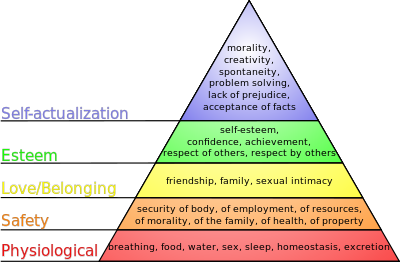
With out new found wealth and suburban explosion, we expected the best schools and similar level of infrastructural support to follow. For a time it worked, but upkeep has proven to be the problem. The infrastructure and population density are spread so thin that we put so much pressure on such brittle apparatus that it begins to collapse due to overuse often caused by our dendritic arterial system versus a more choice-laden, adaptable and dispersive grid network and underfunding.

So getting back to why the City of Dallas's budget shortfall is 20x less than that of smaller cities as discussed earlier, Dallas is lucky in that it is landlocked by its suburban neighbors. Dallas proper can do very little in the way of new growth, which has mostly happened in areas like Rockwall, Mansfield, and Frisco, meaning less no roads (despite everyone from the City to the State, to COG, and to TxDOT's best efforts). So we can ideally focus our efforts on QUALITATIVE over QUANTITATIVE growth.

This is unlike Houston which annexes all of its growth. The future of these two cities can go either way from this tipping point we have reached due to their nature. Houston could become much more responsible with its growth, spending, inertia, and annexation or Dallas could be more successful as it can focus on a much smaller land area.

Where this bites Dallas in the butt, is that there are so many commuters coming in from Richardson, Plano, Arlington, Mesquite, et al., this means Dallas ends up with a very high freeway miles per capita number. Essentially because commuters' trips to Dallas are subsidized at the expense of state and federal taxpayers, but the real cost is the burden on the well-being of the City itself.


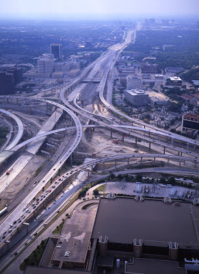
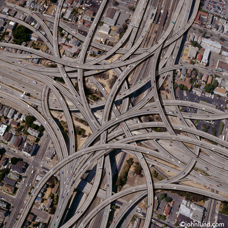
Often when the argument of mass transit comes up, I'm both dumbfounded and frustration by the simplicity of the dollar values and supposed wastefulness that is bandied about. Such things as revenue generation, long-term maintenance, real estate values, etc. are always ignored in favor of startup costs strictly against Mass Transit. Well, how about we take a look at how much embedded wealth we have sunk into all of our roads in Dallas.

**Disclaimer: Very rough numbers.

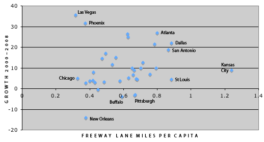
The chart above shows the City of Dallas at .88 freeway miles per 1,000. This chart from 1999 shows freeway equivalent miles at 1.291. I'll use this number because freeway equivalent sounds an awful lot like freeway. Call me crazy, but I'll assume it costs something similar. Also, note how many Texas cities in the top ten. And we wanna build another one as part of the Trinity River Project? Sounds like a good plan (or a racket).

So we know that we have the freeway equivalent of 1.291 lane miles per 1,000 people, approximately 1.3 million people at a density of 3,605 per square mile. And a land area of 385 total square miles. This suggests that 1 freeway lane mile in a congested urban area can cost upwards of a $100 million multiply that over the 1678 freeway lane miles in the city and we get a cost of $167 billion or a cost of $130,000 per person.

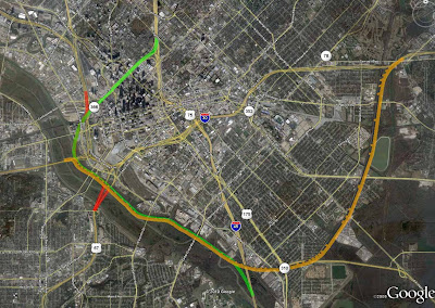
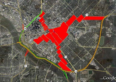
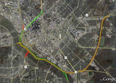
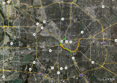
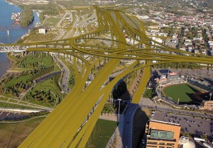
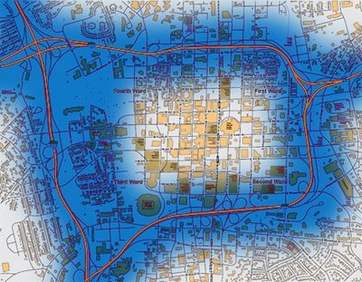
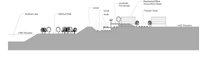
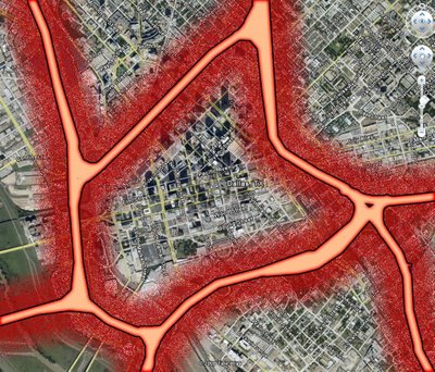
But, what about the other roads? Since Dallas was built on mile-square arterial grids we're going to apply this pattern to get a sense of how many overall road miles there are per capita in this city. As you can see in the graphic below, each super block is bound by 1 mile length arterials and further broken up into blocks by internal collectors or residential streets. The total perimeter equals four miles, but I'll go with half that or 2 miles because each arterial is shared by another 1-square mile super block.


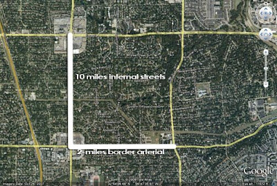
Internal to this superblock, I will estimate approximately 10 miles worth of neighborhood streets cross this block. This is more difficult to get a sense for as each superblock is subdivided differently due to geography, density, or whim. But, to assume the equivalent of five N-S and five E-W streets is pretty conservative considering that leads to about 800' x 800' blocks, not unusual for the 'burbs.

At 3,605 people per square mile in the city that means that these blocks then have .00277 of residential street per capita (not unreasonable as that equals 14' of street frontage) and .00055 arterials per capita. I'll cost the residential streets and infrastructure at $5 million per mile (which assumes NOT a very nice streetscape) and $10 million per arterial.

If we are to extrapolate these superblock numbers over the entire city that means we have spent $7.2 billion on arterials, and $1.8 billion on residential streets and infrastructure. Add in the freeway equivalent costs and we are at $176 billion dollars JUST for construction, or $135,384.62 per Dallas resident. Did we realize we can't afford that?

Next time somebody complains about a transit line costing X amount of dollars throw some similar numbers like that at them. We already know the difference in quality of place the two create.

Maybe to save our budget and essential city services, we can stop building or "upgraydding" roads and start building for people, not for cars.
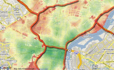
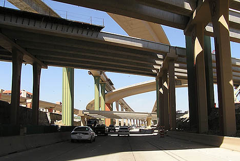
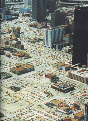
Better caption? Money Well Spent or Return THAT Investment?
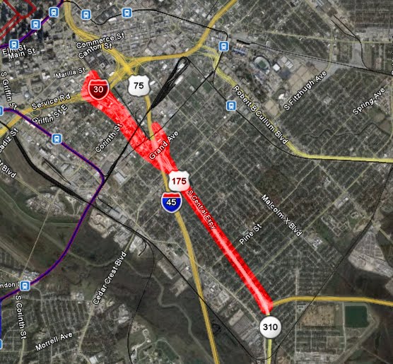
Friday, June 5, 2009

Friday Pondering Brought to You By This Morning's Shower

Some say our city, Dallas (or for that matter any sun belt city) just isn't built for any form of transportation other than car travel AND we're SO spread out, no other form makes sense. We're stuck with it, may as well make it work. I see this as a form of reverse chicken and egg.

It's more like all we have to eat is a rotten egg and a chicken infected with bird flu and told to survive.

To quote Mayor Carcetti from the single greatest and most profound television show ever created, "how many bowls of shit do I gotta eat?!"

-----------------

Side note for the day...is there a way to keep the homeless from defecating all over the city's sidewalks at night??? My dog decided it would be a good idea to roll in some when I wasn't looking and after a morning spent scrubbing and bathing I still feel like Lady MacBeth.

Thursday, April 16, 2009

Thirsty Links

"No more taking off your shoes..."

The President's address on high speed rail today (link to video)
There are those that say this is too small. This is just the first step to a long-term effort.
Good to hear. He also mentions that the first allocation is strictly towards upgrading existing lines.

TreeHugger on Carbon Emissions Do Not Equal Happiness. Apparently, their collapsed economy doesn't have Ireland and Iceland feeling the blues. Perhaps also they don't derive their happiness from a daily stock report as if it were their daily horoscope...ewww 1-star day. Also, I love the contrasting pictures:

Copenhagen:


Dallas. Yay, we're famous!


And lastly, a fascinating map on job losses per county monthly over the last two years, at Slate. Texas is getting off easy thus far. 230,000 jobs lost in LA county alone. How much longer til the full-on backlash against Hollywood extravagance I wonder?

Lastly, on a happier note, WorldChanging on the 20-minute city, using Seattle as a template describing the City where every need is met within a 20-minute walk. Step 1 to a high-quality neighborhood:
When it comes to getting around Ballard, alternative transportation seems to be king. Driving a car to this neighborhood will cost you time and money. Luckily, you don't have to. From downtown Ballard, almost everything you need is a quick hop, skip and jump away.

Thursday, March 26, 2009

Woodall Rogers Deck Park: Consider it Stimulated


From the Real Estate Council:
Transportation Enhancement Stimulus Funds Awarded to Woodall Rodgers Freeway Deck Plaza

Landmark Dallas Project Moves Forward
DALLAS (March 26, 2009) - The Woodall Rodgers Park Foundation will receive $16.7 million in federal stimulus funds toward constructing a deck plaza over the Woodall Rodgers Freeway in downtown Dallas. The Woodall Rodgers deck plaza is a "shovel-ready" transportation enhancement project that will create approximately 1,000 immediate jobs and will stimulate additional economic development and job growth in the future.

The project will provide a vital pedestrian and bicycle connection between both sides of the existing freeway, connecting Downtown Dallas, the Arts District, and the Uptown and Victory residential districts. The Woodall Rodgers Park will be a 5-acre urban park built on top of the deck plaza structure.
And, far more importantly...it is a way to ameliorate the catastrophic effect highways have on property and, in turn, cities.

Although, I'm currently working on a series of diagrams to show how a systematic deconstruction of the inner downtown ring can really leverage private development, job growth, and a much much better city.

[Addendum: I forgot to add that RTKL won an AIA award for presenting the idea of decking Woodall Rogers with a park...in 1979.]

Monday, March 23, 2009

Another Highway Bites the Dust

In an effort to, as the vision statement suggests, enhance "opportunity and equity, livability, sustainability, and civic responsibility," as part of the newly published NOLA plan 2030, the elevated I-10 freeway through downtown New Orleans is coming down.

Nola.com on the new masterplan and the actual masterplan is here.

Hip hip hooray.

Monday, March 16, 2009

Bizzy Day

So more Monday Afternoon Links...

The Infrastructurist on the 7 Most Ridiculous Roads as part of the stimulus:

Check out number 1, Louisville's doozy in downtown...


TIME, on the big ideas of 2009: #2 Recycling the Suburbs.

These words look like they're directly from my mouth:
Not every suburb will make it. The fringes of a suburb like Riverside in Southern California, where housing prices have fallen more than 20% since the bust began, could be too diffuse to thrive in a future where density is no longer taboo. It'll be the older inner suburbs like Tysons Corner, Va., that will have the mass transit, public space and economic gravity to thrive postrecession. Though creative cities will grow more attractive for empty-nest -retirees and young graduates alike, we won't all be moving to New York.
As I have said many times, hard times will flush the chumps (unfortunately, the undertow is pulling a lot of good people down with it). In this case, Fast Company says that Urbanists are the big winners as sprawl's fatal flaws have indeed been, uh, fatal.
A study by the Metropolitan Institute at Virginia Tech predicts that by 2025 there will be as many as 22 million unwanted large-lot homes in suburban areas.

The suburb has been a costly experiment. Thirty-five percent of the nation's wealth has been invested in building a drivable suburban landscape, according to Christopher Leinberger, an urban planning professor at the University of Michigan and visiting fellow at the Brookings Institution. James Howard Kunstler, author of "The Geography of Nowhere," has been saying for years that we can no longer afford suburbs. "If Americans think they've been grifted by Goldman Sachs and Bernie Madoff, wait until they find out what a swindle the so-called 'American Dream' of suburban life turns out to be," he wrote on his blog this week.

Monday, February 23, 2009

Quote for the Day

A critic such as Frederick Ackerman in 1925 could dryly note that "a community with a stable population is now referred to as a dead one." Interestingly, this was in a paper titled "Our Stake in Urban Congestion," noting that contemporary proposals to "solve" urban congestion by building elevated and limited access highways would kill the golden goose, which is based on the ability to tax the increases in land value and specialized transactions that cities create.

Wednesday, February 4, 2009

Links

Pretty sure I posted part 1 of this "Saving the Suburbs" series in the NYT blog, but here is part 2.

I have to admit, I didn't find anything of real substance in part 2. Here is my comment referencing the super happy save the world suburb (of like twenty houses in car-friendly Austin):

The Sol project is as net energy zero as the cars are that access the development. Not to say there is anything particular wrong with that, but to say this particular project in a sea of tract houses doesn’t actually prove anybody right or wrong.

The real issue is that American cities grew in size/land area, but not in the requisite population, i.e. they didn’t grow organically, aggregating new development with all the services and community infrastructure to be successful in addition to existing development. Rather, we robbed Peter to pay Paul, leaving our downtowns and cities to rot while we all moved into suburban neighborhoods that were principally bankrupt and were only about delivering product to the market place, not making real places with lasting value, socially, environmentally, or ecologically.

See my post on Valencia, ESP for a city and suburbs that work and grew organically to do so:

http://carfreeinbigd.blogspot.com/2008/06/valencia-spain.html

The primary issue is that there is an appropriate choice for housing types and living environments and that is represented by the current city form in Valencia. In the US, you generally have one place to live, trapped on your cul-de-sac and behind the wheel.

I’m sure the car, road building, oil/gas industries love having a captive market.
Link to a new website that catalogs Freeway Teardowns. But, the real gem is this article pasted on the site, from Induced Demand to Reduced Demand, which is exactly the issue incapsulated into one neat and tidy heading.
This is what transportation planners call "induced demand." Building freeways encourages people to drive longer distances: in the short run, people begin to drive to regional malls rather than local stores, and in the longer run, they move to lower density neighborhoods where they have to drive further for all their trips.
The convenience of driving has become our [and its] own worst enemy.

Road construction, in the attempt to alleviate the pressure further spreads people out and thus creates its own demand to fill the newly created supply, so we're back to square one...only amplified. The real answer is demand side solutions that reduce the need for trips and driving for every facet of life. As my post yesterday suggests, our happiness and well-being depends upon it.

If you're tired of me b!tching about the highway problem affecting downtown Dallas, move to Charlotte...no, wait a minute. Don't do that. Check this figure ground of downtown Charlotte and how it has essentially been wiped out except for the very center that is in itself buffered by distance and an eroding urban fabric (much like the four blocks of Main Street that work in Dallas):