Showing posts with label Retail in the 21st Century. Show all posts

Wednesday, January 25, 2012

The Resilience Quotient and Malls in Drag

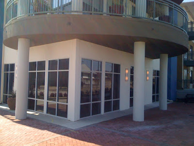
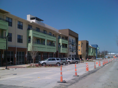
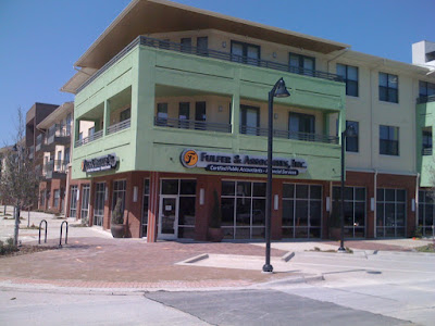
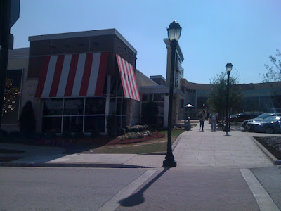
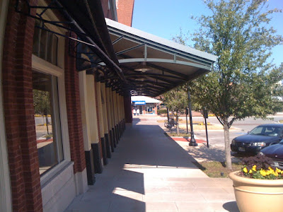
A developer with his "mixed-use town center."

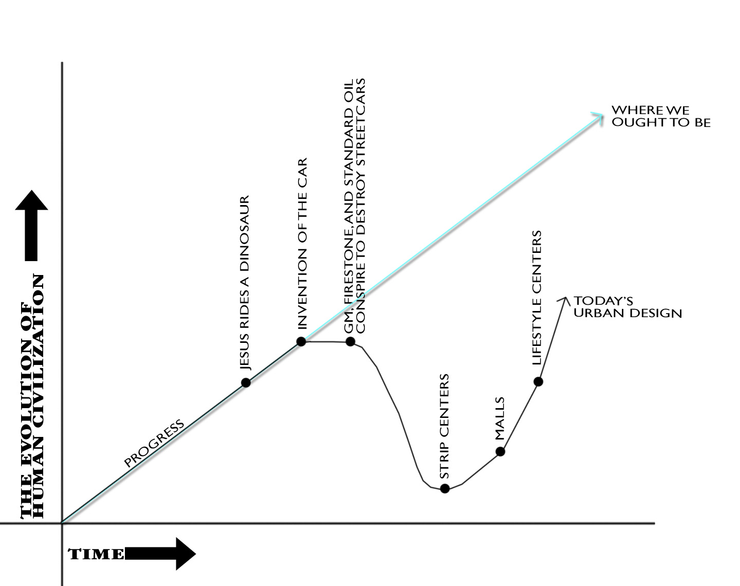
New Yorker architecture critic has a new article up on the American Scholar about his last visit with Jane Jacobs in 2004. It is well worth the read, particularly my favorite bit:
Not the least of the price we pay for having so many of Jacobs’s views become the common wisdom is the extent to which they are now co-opted by real-estate developers and politicians. They have realized that there is money to be made in shopping centers created as fake villages with pedestrian “streets” leading to “town squares,” and in “festival marketplaces” that are little more than shopping malls in drag. Developers proclaim these places to be like real cities, as if they were a natural outgrowth of Jacobs’s ideas. The term mixed use, which started as a sharp-eyed writer’s observation of what underlies an organic urban fabric, has become a developer’s mantra.
A few years ago I was consulting for a city in Nevada. They had such bad experience with past new urbanists and moreso the developers behind the new urbanists, that I wasn't allowed to use any number of buzzwords in the realm of sustainability and urbanism. They had been promised so much before in order to get entitlements, but then what was delivered was little different than the sprawl they were used to. They were tired of being lied to.

Everybody is using words like "mixed-use" as a sort of panacea. I disdain this kind of talk. In a D Magazine column, I derided developments like the malls in drag masquerading as urbanism as baking a cake with all of the ingredients but not following any of the actual instructions. All you end up with is a vat of goo. A checklist of buzzwords like "mixed-use," "live above the shop," "garage parking," "main street," etc. etc. are all bull shit. At least how the majority of urban design consultants use them. We think of these buzzwords, these superficialities as causes, goals, when in actuality these are effects. They are symptoms, by-products of something deeper (the emotional impulse towards real urbanism that I often write about. This results in form that is conducive to encouraging social and economic exchange. The result is the physical form that we call "urban."). And with all the promises of cake, they are they end up building goo.

It is my contention that there are various metrics emerging allowing us to understand the demand and resiliency of a place. As I pointed out in my last article for D Magazine, one of these metrics is intersection density. I'm currently working with a software developer in exploring whether we can tap into open source mapping data to turn this into a program, much like walkscore. For the time being, I am counting intersections effectively by hand.

In the linked D article, I included calculations of two of the premier examples of infill urban redevelopment: State-Thomas uptown Dallas and the Pearl District in Portland, OR. The baseline as figured by UConn Prof. Norman Garrick is about 225 intersections per square mile. State-Thomas has 250+ and Pearl District has well over 400.

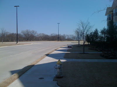
Obviously there are limitations. You can't have a million intersections per square mile because then there would be no room for development. It would be nothing but roads, which seems to be the plan for downtown Dallas. Snark snark.

Furthermore, I've begun creating tiers for which these should be measured and then proportioned to the square mile metric. For example, since neighborhoods are by nature radial, organized around a center (even if the road network is rectilinear), centrality prevails. So instead of using an actual square, I've begun using circles. A circle with a radius of 2,979 feet equals a square mile in area. But, when using the ten-minute walk of about .45 linear miles to the center of the neighborhood, this equates to .63 of a square mile. This would be the neighborhood scale resiliency metric.

Ultimately, I want to be able to qualitatively categorize intersections into a hierarchy of values. Also, it needs a contextual metric as well. For example, Fair Park may have a strong historical grid (which it actually doesn't - but roll with me) within the .45 mi. radius, but if it is circumnavigated by a highway, or several highways and rail lines, fragmented from its surroundings, its neighborhood score could be high. Therefore, it needs a contextual resilience metric as well to tell the tale.

There is also the caveat that this is not a tell all. It must be done within the context of other analyses. For example, California required masterplanned developments in the Valley to build all of their roads upfront. Today, many of these developments exist almost like deserted towns, entire road networks, but only a smattering of houses. Who cares what the intersection density is here, because it was built with entirely artificial demand bubbling up over a boiling lending market.

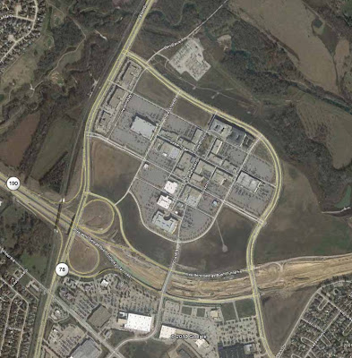
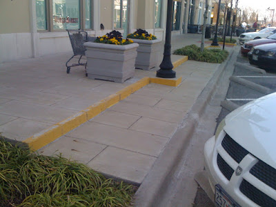
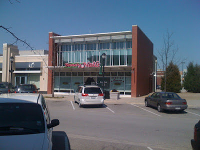
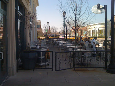
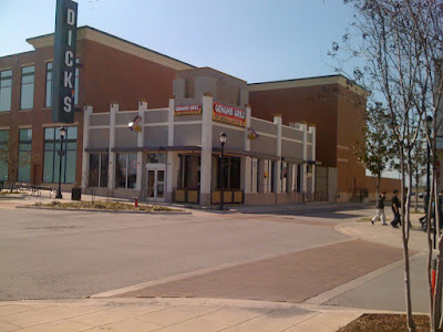
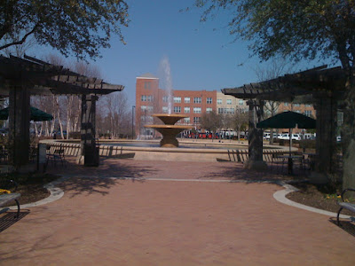
For now, we'll stick with neighborhood score to look at a few malls in drag or Potemkin Villages. Note: each is mapped with a .45 mi radius from the approximate center of the "neighborhood."

First, Victory - which I wrote about how to save it for D.


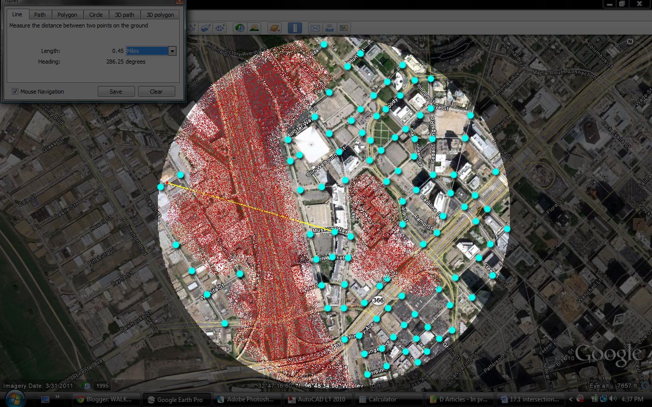
Total intersections: 96
Intersections per sq.mi. (x/.63): 152
Resilience quotient (y/225): 67%

Note: State Thomas resilience quotient would be over 100%. It is also in high demand, occupancy rates are high and every little sliver of land is slowly, but surely being developed. There are a few ways to look at this number. One, is to see an area that has a high quotient, but low level of development and see opportunity. The next step would be to examine its context to see where the breakdown occurs. Second, is to look at an area like Victory and see a deficient quotient and then begin looking to its surroundings to what can be fixed to up the quotient in the neighborhood.

Looking at the map we see the breakdowns come on both sides of Victory, from the highway and the effectual super block that is the Jefferson Apartments (or whatever they're called these days). It's not actually a terrible score, but considering the amount of density built in Victory, the score needs to be higher. I expect this is partially to blame for the poor performance of the development compared to expectations. Looking deeper however, there are a number of intersections in the LoMac, or Lower McKinney, area. Given what we know about how horrid this spaghetti of intersections is, the score for this area is inflated. So we're missing a qualitative component which helps demerit this area for how truly unsafe and disruptive the street and intersection design is in this area, given that nobody walks the short .25 miles through it to the American Airlines Center.

Next: The shops at Allen and Fairview, which I wrote something here about and received a good bit of hate mail from nearby residents so proud of their new development:


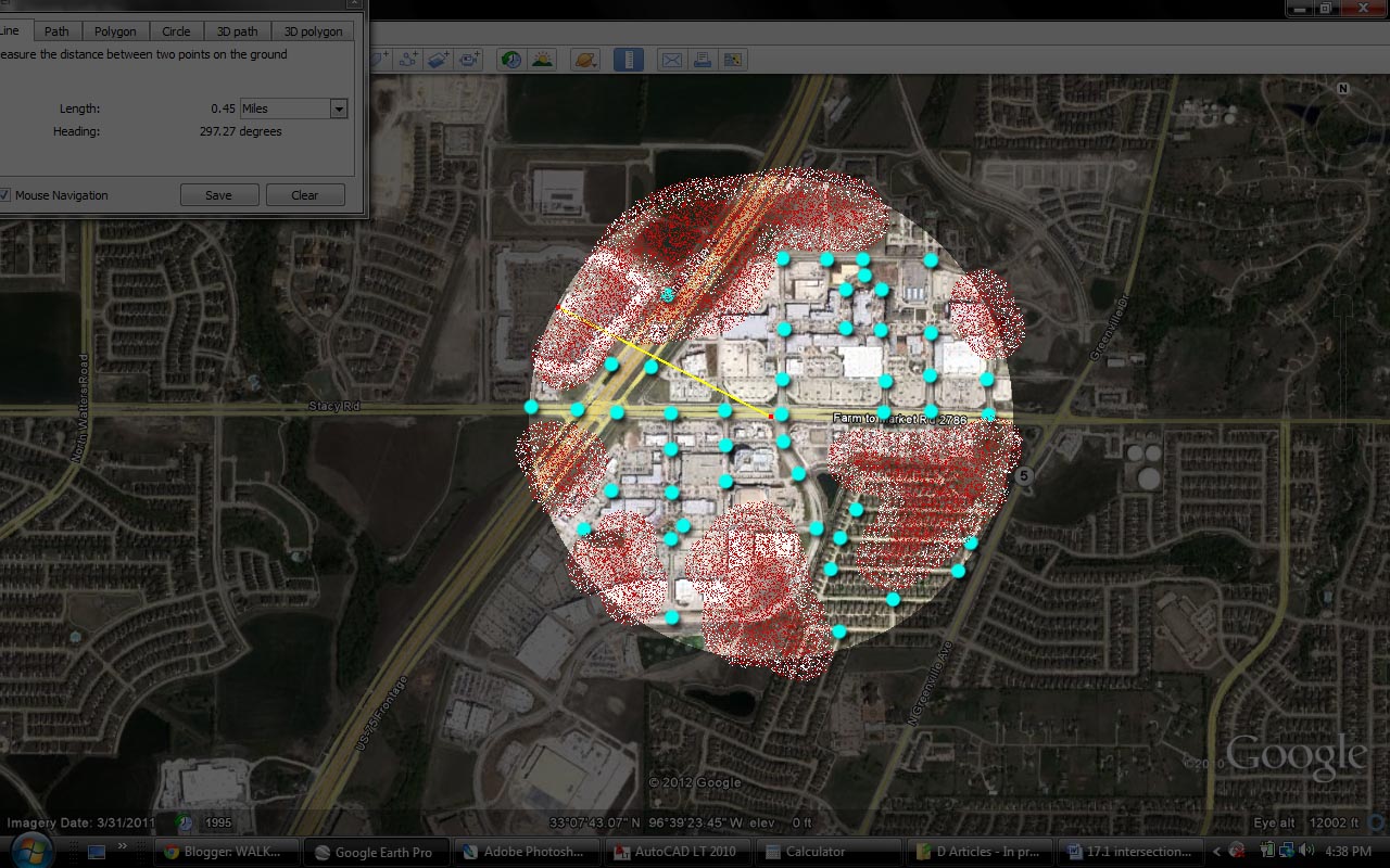
Total intersections: 46
Intersections per sq.mi. (x/.63): 73
Resilience quotient (y/225): 32.4%

Verdict: Mall in Drag. You can see the breakdown comes from the poor connection to its surroundings, the highway on one side and the neighborhoods on the other that are completely ignored. It exists in a bubble, surrounded by a sea of parking, in other words, a mall without a roof. And malls are failing precisely because of their poor connections to their surroundings.

This development could likely be salvaged if the number of intersections is doubled since the density is not terribly high, I'm not sure it needs to get up to 100%. However, if it begins to struggle will the demand ever exist to instill the impetus for such infrastructural reconnections?

Next:
Park Lane Place, which I was interviewed about here and said the following:
Whether the development will flourish is something we’ll have to wait to find out. But there is reason to question Barnett’s assumption about the need to “internalize” the development. Patrick Kennedy, an urban planner and designer, has spent some time walking around Park Lane. He says a development like this one needs to do two things to succeed. “It has to be so well-designed, so lovable that the citizenry will always care for it and ensure that it endures,” he says. “The other is, it has to tie into the rest of the city, the adjacent properties, neighborhoods, street network, and transportation framework so that the improvement, stewardship, and resilience are mutually ensured. I’m not sure Park Lane successfully accomplishes either. I think the underlying logic defining Park Lane—that of convenience—undermines certainly the latter and possibly the former, as the experience is ultimately degraded by the disconnection, no matter the level of detailed design.”

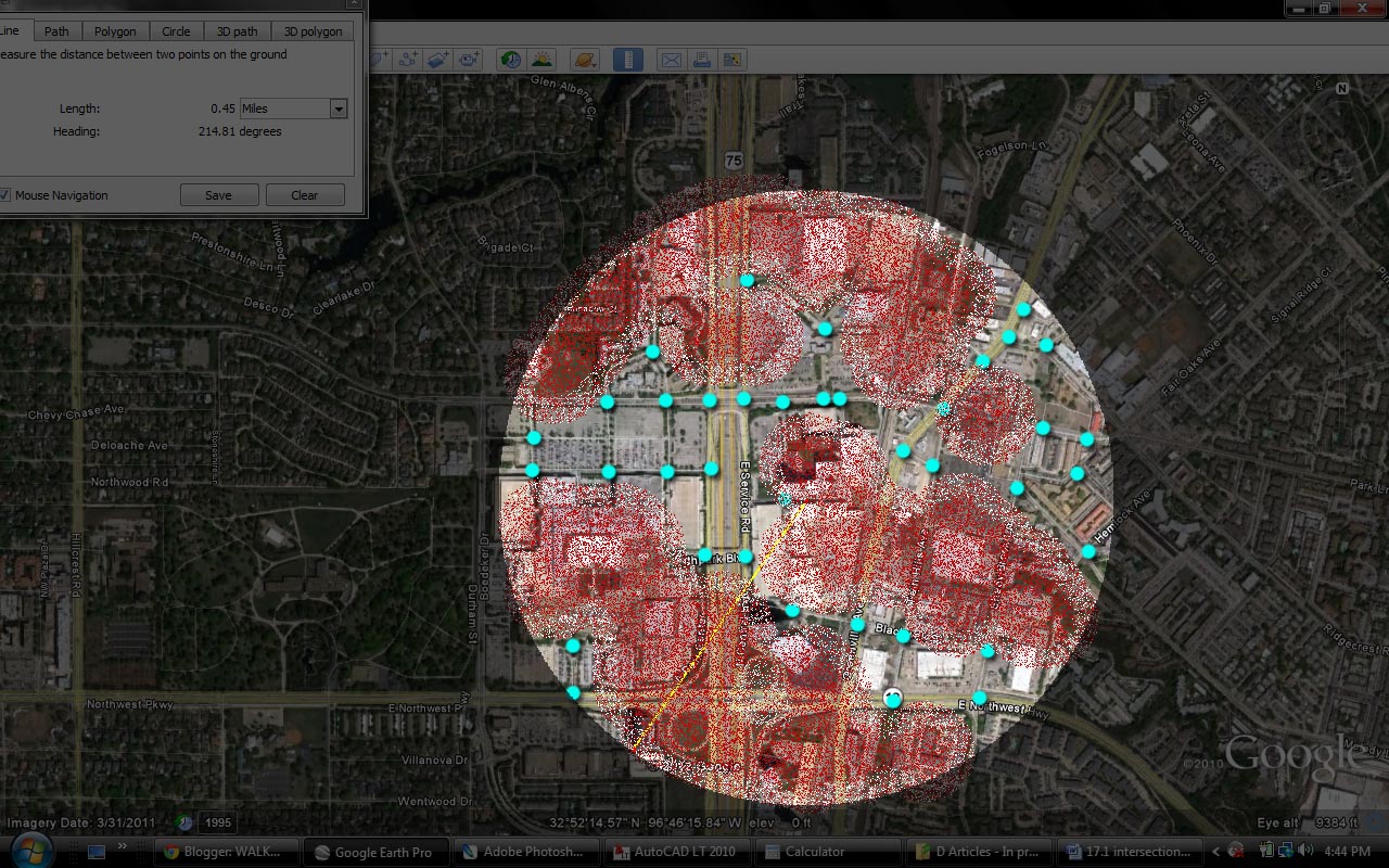
Total intersections: 37
Intersections per sq.mi.: 58.7
Resilience quotient: 26%

Verdict: Ayeeeeeeeeee! Run for the hills! It has the North Park Mall on one-side and even the mall has more intersections. That isn't really why North Park is still succeeding why all other malls are failing. Instead, it is succeeding partially because of its location and partially because it exists as THE mall in the region. Any region can only support a handful of malls at best. If I were to take a stab at a ratio, it might be a 1:1 ratio of square feet per population. Meaning a 1 million square foot mall per 1 million population. And even North Park is slowly but surely repositioning itself. I expect its surface parking lots to infill eventually.

The real breakdown with Park Lane Place is not just the poor connection to its surroundings but the design on-site itself. There are very few actual blocks and convergence points created. This is further exacerbated by the changes in plane, Whole Foods and other stores are a few stories above the street level, accessed by an elevated parking garage, disconnected from everything else.

My guess is that PLP could have done a bit better if a legitimate street and block structure was created on site. However, even if it had done so, it would have been limited by its poor connections outward. Given that it has a roughly equal amount of density as Victory yet half the resilience quotient, it is pretty easy to see how this development has failed and will continue to flounder long after Victory rights the ship.

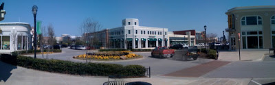
Let's contrast these with a successful development: Legacy Town Center, aka Shops at Legacy

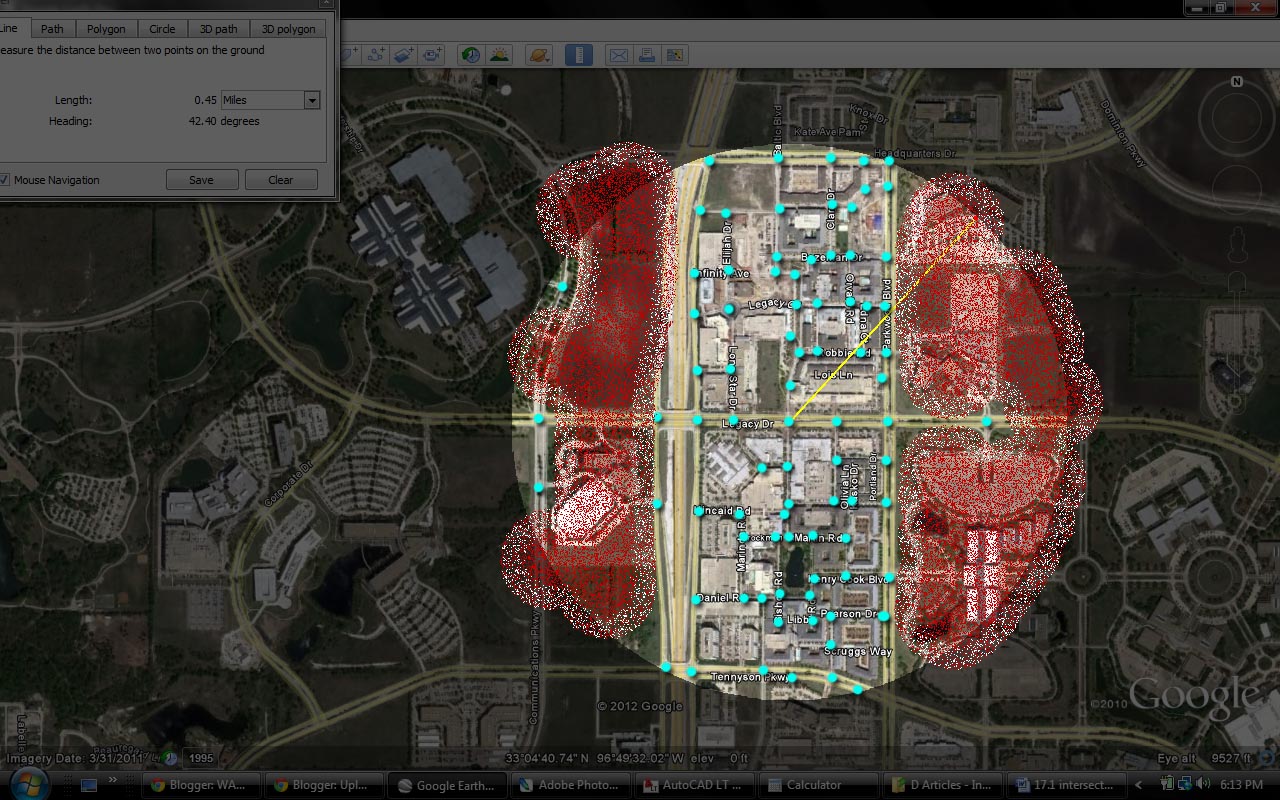
Total intersections: 80
Intersections per sq.mi.: 127
Resilience quotient: 56%

Verdict: It's quotient is lower than Victory's but higher than the others. Which makes some sense as the density delivered is also much lower. However, with closer examination and when looking strictly at the approximately .26 square miles that the development consists of, this number jumps to 308 intersections per sq.mi. or 137% resilience quotient. It's breakdown comes with the corporate campus sites which have few roads.

You could say this is an isolated development, much like a mall without a roof. I've heard and read of a number of critics, professional and otherwise use this criticism. Similarly, it is a cut and paste criticism of my objective critiques above clumsily and inappropriately applied. Just like when creating "mixed-use" in all the wrong places and without the proper foundation.

This is the case for two distinct reasons:

1) This development has a better housing to retail/jobs ratio than do typical "town center malls in drag" which are nearly entirely retail. And more importantly,

2) The connections to the highway and surroundings are still quite good. And furthermore, these corporate campuses can be eventually infilled as there is already thought of doing so. It makes perfect sense. Many of these corporate office parks have excess land while trying to reposition themselves and their businesses. One of their major assets is land. Legacy, rather than being a disconnected, isolated entity, will actually be the catalyst for expansion and interconnection as its urbanism spreads outward.

Monday, March 8, 2010

CarFreeInBigD Field Trip: Garland & Firewheel Town Center

...where the devil is in the David Schwarz details.


I had the chance recently to go visit downtown Garland and Firewheel Town Center. I'm a bit ashamed to say that this was my first time to downtown Garland, but my second to Firewheel. Ironically, you may be aware of where Firewheel is, the de facto downtown of Garland for the highway oriented, but like me, you could say, "Garland has a downtown?" Then, "where is it?"

Looking a bit closer at the map, it appears that Garland Road, aka SH 78 once ran along the rail line through downtown. My guess is that eventually, like all efforts to save downtowns, the attempt to "pedestrianize" it actually helped to, at best, put it into a comatose state. In this case, it was (presumably) to create a bypass since intuitively we knew that the road design was so bad, that it was anti-downtown. But, downtowns need that energy, the lifeblood of traffic. The real failure was in the strictly car-oriented and overscaled design of the arterials.

It seems logical to conclude that this effort to bypass the town, effectively created the disconnect of cognitive awareness of most of DFW with where downtown Garland actually is located. One of Garland's challenges as it attempts to further revitalize its core, is to raise the awareness of downtown within the region.


One reason for going out to downtown Garland was to check out the new development around the historic square, how it relates to downtown, as well as the DART station. As you can see below, it fits snuggly between the aforementioned DART station, the performing arts center, and the historic downtown square. However, the performing arts center and 5th street aren't exactly the most pedestrian friendly buildings/streets in the world, creating a bit of an obstacle for linking the new residents to the DART station as well as potential regional visitors to the historic square from DART.

Furthermore, and this might be a crazy idea, it might be an idea worth pursuing to help raise the awareness of downtown Garland square, by demolishing the buildings on the same block as the plaza, and rebuilding them (possibly) or something else on the block to the east. This would open up the square to the predominant connector (5th), reposition the block east for redevelopment, and open up the square to City Hall which is a block to the northeast.


When arriving on DART, once navigating crossing the tracks and 5th, the new mixed-use/residential building greets visitors. There are things that are good about the building...and things that are not good. But, at this point, those are minor details. In the grand scheme of thing, a new mixed-use project was built, where it needs to be built: near a historic downtown and near a DART station.


I rather like this corner treatment. I thought it was a clever way to turn the corner of the building while maintaining more efficient/constructable floor plates.


However, if I was to offer a couple of suggestions; I would have chamfered this corner storefront to present a face to DART riders and mirror the axis of the balconies above.


Further, I think I would suggest carrying the element up one more level to give a roof for the 3rd floor balcony, or at least extend the blue box to accomplish the same idea. Either the box or the oval element could use strengthening. They are competing a bit.


Garage entry, offset from the building face, which is fine. Some similar "Texas Donuts" extend the wrap all the way across. However, this building already at 430 linear feet on this block could use the break up of its mass.


I do get the sense that in the effort to articulate the facade of the 430', the designers went a bit overboard. Particularly, with the colors. I think I would prefer to see more muted colors with this much articulation and allow the shadows to provide the visual interest.


And really, this green needs to go. Anybody got some paint?


Below is a new building, that looks like new institutional offices, but I've yet been able to track down what it is. Any clues? It looks well executed thus far.


Two details. Why not to make 90 degree parking without some outlet for the drainage. Debris builds in the corners.


Switchgears. Who needs to hide them? Camouflage silver on the sidewalk works perfectly fine. I have no problemo with this.


Firewheel Town Center.


I've often discussed the trendline of retail: after cars and suburbs effectively gutted historic 'high street' retail, retail followed rooftops out to the edges in the form of typical drive-to strip centers. Often these were still pulled out to the street, but developed linearly along old streetcar lines.

http://3.bp.blogspot.com/_D5kx0bUGx_c/SDSTr3WxsYI/AAAAAAAAAHU/VdalYlYSUzk/s1600/graph.jpg

Eventually, cars demanded more space, as did retailers and new suburbs sprouted further out. The next iteration of retail was the drive to strip center, entirely devoted to the car trip, even turning its back on adjacent neighborhoods with its loading dock and dumpsters.

Next, we realized that the downtowns did something right. They got people out of their cars AND they clustered stores creating synergies in a manner suitable for cross-shopping. These were the first malls. An effort to create the city outside of the city.

But, they had a problem. They forgot the residential. Residential provided the day/night activity to buffer retail business from the various hiccups in the business of commerce. Before, this was rectified, however, the first conclusion was to remove the roof from malls creating town centers. But, something was missing. Was it cars?

Not really, but the effort was made anyway and the next iteration of the drive to shopping experience was the "Main Street." However, this was a phony main street thru a mall without a roof. These have had some success, but ultimately are still a poor representation, are disconnected from their context, necessary for what I call urban resilience. Resilience is based on care. We have to care about property for it to last. If something is disconnected, there are far less potential 'caregivers' looking after a place.

So, new mixes of uses were introduced such as small office above retail and some residential. In some cases the residential was above the retail, in others, like at Firewheel, it is off to the periphery.

Looking at the aerial above, you can literally see the etymology of retail. It follows the fundamentals of mall design to a T: pad sites for chain stores out front, moat of parking delivering cars from the highway intersection, anchors terminating each axis.

Panorama at the "main and main" intersection:


This development was largely designed by DC architect and irrepressible classicist David Schwarz. Discuss the architectural stylings as you will, frankly (and as I've stated repeatedly) style is the least of my concerns, particularly with Firewheel. My concerns are threefold: the resilience of this prototype and the poor coordination apparently between the architect, landscape architect and the civil engineer resulting in some horrid decisions and outright flaws in the pedestrian realm, and lastly.


Above, we find our first parking spot and the first thing we see is a tripping hazard.


While having outdoor dining is great, particularly with the weather we had that day, this should allow at least 6' clear for pedestrian way. Cities all over the world manage to allow pedestrian easements between restaurants and outdoor eating. In this case, pedestrians have to walk around, literally out into the street to get around.


Typically, block corners are given emphasis. Here we have the opposite and I question it. Historically, the corners are/were emphasized with architectural elements and more mass, because of the greater traffic at intersections creates demand for more density. Also, it creates for more "marketing" opportunities to the increased traffic flow past the building. Lastly, it helps to orient visitors.


These types of centers cater nearly entirely to chain retailers. First concern is their individual stability in doing business. And probably relatedly, people prefer the kind of service that is provided by smaller, local businesses embedded in their communities, more resilience thru essentially customer service.


One reason why I despise angled head-in parking. You either end up with wheel stops looking stupid as they are angled like this, you zig-zag the curb at extra cost, and in my estimation, while it generates more parking than parallel, it feels hostile to pedestrians as cars are diving into spaces. It also creates more distance between storefronts, and Firewheel is very poor about breaks in the parking to allow for mid-block crossings.


Either go with tree grates or spend some money on better planting with some sort of protection like gates around the tree well.


Agh. My pet peave. Pointless grass. Grass while (typically) green in color is probably the worst material in terms of sustainability and usability. It generates runoff at nearly the level of fully impermeable hard surfaces and it requires an inordinate amount of maintenance for its limited purpose. I find often inadequate designers just stick grass wherever they can't think of what else to do. Tip: keep it to play areas, gathering areas, and monumental lawns.


I like these pedestrian cut-throughs aka paseos. These require careful detailing for the pedestrian experience as these paseos provide the primary entry experience for visitors as they move from parking to "main street." The paseo, while good that it is provided, could have gotten some attention from the retail buildings, either entries, better landscaping, or outdoor eating areas, etc.


This feels nice. Here is the square with fountain and trellis where retail transitions to the residential (background building).


However, I think they got a little to literal in my opinion making the transition from retail (the urban) to residential. This translated into an urban square-turned-rocky ravine. I think I would have maintained the formality in this square for more usable gathering space and sub-rooms off of the main space, and allowed the naturalesque landscaping for areas further north where the residential actually might transition towards a real stream.


A little bollard crazy.


Buildings need to communicate with each other. Further, it is a good idea to do so when transitionign from retail to residential to blur the lines. Here we have no relationship between the retail building and the residential. But it gets worse.


Argh. Not only is it more grass, but this is how they dealt with the grading. Completely inaccessible.


While these centers typically plan for infill of the parking lots with parking garages and new uses, in the time being, residential units are forced to look out over a sea of parking.


While I understand the need to break up the mass of the building (and to relate somewhat stylistically with Schwarz's town center), but I don't think it really works here. Feels


While the typical urban design reflex is to pull buildings to the streets. Like all rules sometimes they are meant to be broken. Here it creates front yards for the ground floor residents (or a dog run at one section of it) AND it provides a buffer from the incredibly over-scaled road behind.

Conclusion: I think we'll see downtown Garland return as it has a greater future than Firewheel, unless Firewheel makes significant efforts to infill its parking, develop across the street above, tones down said street, and tries (in vain) to tie into any context whatsoever...or just create that context.

Monday, February 8, 2010

Field Trip: Painting Austin One Admistrative Paintball at a Time

http://api.ning.com/files/4VJZP0oUWpYAWVOSIyrgtiqg8DAoCZ7sMHJNJ6P4T06qsdUd363zau44SSG7UZRLvA2d1Kwh*n7rvm1QtuBLsDPKhSc5L7Jp/Paintball.jpg

(Not me...or any of the other paintballers)

Yesterday, two friends were pulled over on two separate occasions in two different jurisdictions. One was pulled over in Dallas by the DPD and the other by a state trooper outside of Austin, both for not updating their vehicle registration (one had done so, but it didn't yet show up on the computerized database, so that's on TxDOT).

If you want to know how a city and state, built entirely around the automobile in a manner that is proving to be fiscally (among other ways) unsustainable, priding themselves on low-tax policies will try to make ends meet as they see entirely too much of their budgets devoted to building, maintaining, policing, and regulating jurisdictions too sparsely developed to afford, this is it.

Because of an unwillingness to directly tax what ails them (as it is most likely politically suicidal to be honest and direct with you constituents, whoda thunk?), an overextended infrastructural system, in some manner of increased gasoline taxes, toll roads, VMT taxes, etc. we are all about to experience a whole lotta bureaucratic pain, cost, and inconvenience.

The difference will be (and I believe unsuccessfully) made up through increased fees for things like licensing, registration, insurance and the like, as well as much greater enforcement. But, as we all know, this will be a fruitless and ultimately wasteful endeavor as the real solution is quick action to design the "bones" of our cities correctly, allowing for financially AND environmentally more sustainable communities where choice is availed via improved design at ALL densities by a more livable transportation network.

The future of our cities will be both more affordable and more profitable by the increased connections and productivity a more efficient and more attractive configuration of Texas cities. The key for each will be to not fall too far behind the other cities in this process.
--------------------------------
Note: Once again, I was limited to the tools at hand, so all pictures are at the max quality that an Iphone allows, that being poor.


After a spontaneous trip to a friend's 11-acres in hill country for pre-super bowl paintballing weekend, a compadre and myself took a quick detour through a development known as The Domain to snap some quick pictures of the project/place and, in particular, a building of his design.

Unlike the West 7th post, this will be much lighter on commentary. Why? Because I'm busy that is why. Quit asking questions and take a look at Austin's hottest shopping spot.


Above is the masterplan and if you clicky on it, you can embiggen it to a size more suitable to your preferred visibility. You will notice that the majority of what is built thus far is the portion at the bottom of the map (but western side) highlighted in yellow. Having seen numerous pictures of The Domain before, I was aware of how nice some of the spaces and streets were. However, my first impression, having entered around what seemed like the side and back, but marked by the largest monument (pictured above), was that the area was somewhat disjointed.

Having examined the masterplan for the first time after my visit, my initial assumptions about the place are confirmed: that the primary "main street" mixed-use shopping district is rather disconnected from the overall masterplan and the buildings not immediately associated with what is essentially one of the better lifestyle centers in the country. To be perfectly honest, the main street portion is very well executed from the planning and landscape to the architecture of the mixed-use buildings. I am very concerned, however for how this portion will relate to the rest of the masterplan as it builds out.
----------------------------

I use lifestyle center not to be intentionally pejorative, but rather to point out that it is one more baby step along the path towards real urbanity and an interconnected urban fabric. I say baby step, because under the surface the plan is still guided primarily by drive-to retail logic. After malls, we started building "malls without roofs" which were still entirely internalized with seas of parking circling the perimeter of the built product. Eventually, we created "main streets" allowing cars and parking in the internal space formerly reserved for the shopper on foot. Next, we started cutting cross roads through the development, creating blocks at a more walkable, pedestrian scale, adding convergence, and some more of the messiness that defines urbanity.

At this point, these shopping precincts were still often single-use with parking around the edge. All drive-to developments, with more in common with their cousing the conventional shopping mall than to the real urbanism they masquerade(d) as. This is a natural slow progression given the power of retail tenants and the unwillingness for "experimentation" endemic to most national chains (as if real urbanity was more experimental than our previous fifty year foray into auto-oriented development).


I feel like we're hitting a tipping point towards a return to more authentic urbanism defined by the preference of citizens as well as the failings of the "conventional" retail delivery system of the past fifty years. This design evolution seems to be happening at such a furious pace (even though most building has ceased), that even The Domain is feeling a little aged. I don't mean aged from a detail design standpoint as much as its format.

It has two improvements on the conventional lifestyle centers mentioned above. First, is that it has added a significant residential component above the retail allowing for some 3-D convergence. Second, it connects into existing developments and adjacent fabric better than most allowing for "projects" to feel a little less contrived as they nessle into their surroundings.

With that said, however, after comparing notes between on-site visit and masterplan perusal, I can see a bit of a disconnect forming between the various districts. Understanding fully well, that many future phases of masterplans are little more than placeholders, the "bones," i.e. the block shapes/sizes as defined by the road system are typically pretty fixed. These are also the elements creating what appears to be shaping up as different "places" loosely cobbled together rather than one district defined by complementary sub-districts.

There is too much undefined space. In Space is the Machine, Hillier hypothesizes that undefined public space is THE cause not symptom of disinvestment. In the masterplan, look at all that green. Typically, one might think of green as good. It's open space right? How can we go wrong. It becomes a negative element detracting from the overall place if it is not properly bound and engaged by its surroundings, ie buildings and streets. I see too much of this type of space in the future phases.

While some blocks do relate to each other, others don't creating fissures between what appears like five or six distinct precincts that could have th effect of competing against one another rather than complementing one another, even if significant efforts are made to regulate or dictate the character, uses, and nature of each sub-district. As I'll show below, the first of these fissures is already apparent between the shopping precinct and where the two hotels are located.


Above is the new a-loft hotel. I feel certain that there will be enough cross synergy between the hotel patrons heading into the "main street" and residents to the trendy WXYZ bar in the a-loft lobby that will overcome to some extent the barrier effect caused by the backdoor feel of this street, not too dissimilar to Houston Street adjacent to (behind?) Victory in Dallas.


Many spaces were designed around mature live oaks (not sure if they were relocated or not) which provides for an aged or mature look to many of the people spaces.


Okay, I might have to cut some of this short because blogger apparently defines "improvements" much the way a typical traffic engineer might, making formatting a miserable experience. Below is...hmmm...well, I guess there have to be a few lapses in taste. That is one storefront built at what 3:1 scale?


Above, I enjoyed that topography was used, embraced, not scraped flat, providing some more authenticity to the place as a whole.


Alas, what do we have here? Infant toys! There isn't a much better indicator of the quality of a place than if somebody is willing to raise their child there (particularly if they have the type of disposable income allowing them the choice to live in a place like The Domain). So there we have it, what has been built to date is a success. I'm waiting to see how the rest of the pieces of the puzzle come together. Will they detract from the first phase?